
Pacific Coast | Mile 0 | Strava
I awoke to a sharp gust of salty air that tore through the canopy of bushes above me, sending their leaves whipping like flags in the wind. The sky was still quite dark, though I could see headlights in the parking lot down the hill. I'd had a restless sleep, paranoid that some stern-voiced ranger would stumble upon me cowboy camping and cancel my trip before it'd begun. I was planning to run all the way across the United States, and I knew that if I wanted to make it cross-country, I'd eventually have to get used to stealth camping - the first night seemed as good a time as any to break myself in. For a few years now I had wanted to experience America by foot. Earlier that spring, realizing I had an opportunity, I'd jumped at the chance with only a few weeks' notice. Now here I was, about thirty minutes from starting a journey I couldn't begin to comprehend. The howling wind coming off the Pacific Ocean hid the sounds of my rustling as I packed away my sleeping quilt and snuck back to the shoreline trail. I gave one last backward glance to appraise my cowboy camp - I had been pretty well hidden - and struck out toward the beach.

Westport State Park didn't open for a couple hours yet, but there were other silhouettes walking toward the roiling gray ocean as the sky
above began to lighten. It was a good thing I'd decided to camp farther from the jetty. I set up my GoPro on a rock, hoping to catch a time
lapse of the sunrise, and bundled up against the chill wind. The first golden rays brought a warm flood of hope for my adventure, and with
memories of my restless dirt mattress temporarily forgotten, I practically skipped down the Westport Light Trail toward town.
Every step felt special, filled with possibility, but I had problems from the start. By mile six, while admiring the views over South Bay, I
became aware that my pack was chafing heavily and my chest bruised - the many pounds of water bouncing in my pack were delivering a punch
to the pectorals with every step. I readjusted and carried on. Before the trip, I had insisted on shouldering all my gear in a worn-out
Ultraspire fastpack, seams already torn from years of use, in order to maximize maneuverability. Many transcontinental runners opt to run with
a jogging stroller and save their backs, but I wanted to explore mountain passes and nature trails. A bulky stroller
would confine me to paved roads, so I accepted the sacrifice.
I'd seen Ricky Gates use a pack in Transamericana, so surely I could too.


Lake Sylvia | Mile 39 | Strava
By the end of my first day, I'd made it 38 miles to a campground on the shores of Lake Sylvia. Twice, I had almost given up on my pack. It was only ten pounds of dry weight, but nearly twice that with food and water - a detail I'd neglected in my last-minute test runs back in Massachusetts - and the chafing rendered some pockets entirely unusable. I was simply running out of space. Still, I knew from talking to previous transcontinental runner and CTS coach Patrick McGlade that the first two weeks were likely to be the hardest, and I had faith that my body would adapt. I had no idea how I was going to make it 3000+ miles across the U.S. when things seemed to be falling apart within the first day, but I'd solve those problems when I got there. I took off the pack and walked, tried to soak in the exotic beauty of Preachers Slough (my first real taste of Washington's rainforest), and just focused on making it to camp.

Waking up in Lake Syliva felt like emerging into a magical, tropical wonderland. I packed up my tent and decided to spend the morning exploring winding rainforest singletrack, setting up run-by shots with the GoPro and trying to capture action footage of me vaulting a fallen log. I had never been on social media before, and I was enjoying my Instagram photo-op sidequest. It was a nice distraction from the pack, which was already feeling much better, and it gave me contact with friends and family members (my only followers) on an otherwise solo expedition. By 10am I was shoving a grocery store doughnut into my gullet, preparing to leave the nearby town of Montesano and make good on the day's 40-mile commute. Surely the extra couple of miles this morning couldn't have hurt.


Capitol State | Mile 80 | Strava
When I had been sitting at home a few weeks earlier, planning my route across Washington, I'd thought it would be great fun to route in 3,000 feet of climbing at the end of a 40-mile day. By the time I arrived at the foothills of Capitol State Forest, I'd changed my mind. Something in my ankle had become strained (I use the term loosely), and I hadn't been able to run for over an hour. After starting the slow ascent and fending off a pair of unfriendly farm dogs, I limped into Porter Creek Campground to filter water from the stream. I had another 17 miles to go - up and over the mountains - and at this rate there was no way I would make it to my planned endpoint before nightfall. Ah well. I had to try, and I was still enjoying marveling at the temperate rainforest, with its dawn redwoods bearing capes of hanging Spanish moss and prehistoric human-sized ferns. I walked and, not for the first time, called my family.


Greater Seattle | Mile 110 | Strava #1 #2
By the morning of my third day, my body had settled into a rhythm. The pack no longer hurt - I barely noticed it - my bruises were healed, and I was running smoothly. Nevertheless, I spent most of the day sourcing a jogging stroller. I knew eastern Washington's desert was fast approaching and the pack, bearable though it might be, had proven it lacked the carrying capacity to get me safely across. I selected the cheapest well-reviewed jogging stroller I could find - a Jeep TurboGlyde (what "turbo" means, in the context of a stroller, I cannot say) and fastened to it a laminated sign displaying my transcontinental intentions. I strapped in the Ultraspire pack like a frayed baby, flipped up the stroller window to keep an eye on it, and ran unburdened. With the sprawling Fort Lewis military base complicating my sleeping plans, I took another note from Patrick and knocked on the door of a local fire station just before dusk. The men there were eager to help, if baffled, and let me camp on the condition that I take four boxes of Girl Scout cookies with me on my journey. I agreed. I fell asleep, roused in the night only once by the wail of a fire siren, and more than once by the (surprisingly loud) sound of banana slugs munching on my tent. My friends in Washington saw the aurora borealis above them that night; I saw the massive silhouettes of banana slugs, outlined in orange by the lights of the fire station.


Rattlesnake Mountain | Mile 182 | Strava
My challenges with stroller running began early the next morning. I had planned my route to include trails, and my shortcut out of town took me on rocky, overgrown singletrack complete with fallen logs and steep inclines. The tradeoff I had made two days ago became abundantly clear. Even worse, my route today - another 42 miles - was set to take me up and over a 3,000-foot mountain in the foothills of the Cascades, and was definitely not stroller-friendly. I'd planned my route with komoot, and the app had found me an unmarked shortcut through the mountains on what was apparently the only public road (trail?) through a patchwork of private property. The alternative was a 20-mile detour along the highway, so I prayed my route was valid and plunged ahead. It was a seven-mile climb to the turnoff. If my information was wrong, I'd have to double back and still take the 20-mile detour.The gravel road was lined with NO TRESSPASSING signs prohibiting access to the Cedar River Watershed, but the occasional truck that kicked up dust as it went by gave me hope of public access. As I reached the end of the road I apprehensively awaited the turnoff. There were houses here on the dead-end road - that explained the traffic. Surely I wasn't about to run up somebody's driveway? The route took a sharp left at an unmarked Barkley-style yellow gate. No private property signs, no mailbox. Just an overgrown doubletrack winding up the mountain. I celebrated internally and pushed the stroller up the rocky trail, singing what little of the hobbit's songs I could remember from The Lord of The Rings. This was an effort to stave off hungry bears who, if they possessed any musical sense, would hear my tonedeaf yodeling and run for the hills.

About an hour later, I came upon a lookout to Rattlesnake Lake impossibly far below. The trail onward dropped 2,000 feet in three miles, and was overrun with day hikers scrambling up to the viewpoint. I lifted the stroller up on one tire, did my best to avoid the day hikers (some of whom, seeing I was well-stocked, bummed gulps of water as if my stroller were an unhinged clifside hydration service) and half-manhandled, half-freewheeled my way down the mountain. Filtering from the lake at the bottom, I had just ten miles left until camp. Thankfully, this was the start of the Palouse-Cascades Trail, and I would effectively be running on roads and gravel bike path for the rest of the way across Washington. I reached camp shortly after sundown and collapsed, wrapping my damp tent around me like a blanket, too tired to set it up properly.


Snoqualmie Pass | Mile 204 | Strava
I awoke wet, but warm. I had been fortunate - the weather on my trip, started in early May, had somehow completely avoided the drenched skies western Washington is known for. I released my stroller from the site's pit toilet where I had locked it last night and set out for for the Cascades. Its internment had been due to a poor purchasing decision on my part - swayed by high CPD (calories per dollar), I'd bought a mammoth bag of frozen chicken nuggets that were now defrosted and quite fragrant. Last night I had squirreled the stroller away for fear it might become bear food. My own breakfast, a cheesy rigatoni from the Trader Joe's frozen section, had also gone bad. I ate it anyway. The third and final consequence of yesterday's escapade was a flat tire. No doubt incurred from the gnarly bike trail up Rattlesnake Mountain, this explained my stroller's tendency to list to one side. I had attempted to flag down passing cyclists on the trail last night, hoping for a spare patch, to no avail. It would be another 90 miles before I could get to Ellensburg to fix it. The flat, combined with the rough gravel of the Palouse-Cascades Trail, hampered my progress significantly.

Despite my poor food, inchworm pace, and exhausted body, I enjoyed the start of the day immensely. It was a delight to be in the mountains, with snow-capped backdrops, trestle bridges, old rail ruins, and seasonal waterfalls decorating the well-groomed trail. I had been tipped off back in Tacoma to keep an eye out for Snoqualmie Tunnel, and as I arrived it was easy to see why. The two-mile hole bore straight through the heart of the mountains, a tiny pinprick of white in the distance serving as the only proof of exit. Yesterday a hobbit, today a dwarf, I echoed the Misty Mountains theme under the hollow earth and sprinted toward the light. Multiple times, the exit appeared to approach must faster than expected; this was one of the few sections of the entire 285-mile Palouse-Cascades Trail on which I saw other human beings, and a handful of cyclists passed in the opposite direction with glowing headlamps. Eventually true daylight reappeared, and breaking out on the other side of the mountains, I set off downhill toward the Columbia River 100 miles away.


Cle Elum | Mile 238 | Strava #1 #2
By the end of the day, my exhaustion had caught up with me. The scenery was beautiful, but my plans to restock in Easton were foiled when I failed to find a single living person in town, forcing me to push on to the next town of Cle Elum on an empty stomach. I'd begun my journey without proper preparation, and the mental and physical tolls were starting to add up. I faced three major problems. The first was that I was almost completely broke, and impromptu splurges on the stroller and two hotels ensured that I would run out of money to feed myself before I reached the other side of the country. The hotels were an attempt to solve my second, more pressing problem, which was one of recovery. My timeline was such that I had to average over 40 miles every day, which, with all the other complications I'd faced, simply didn't leave enough time to eat and sleep. I'd weighed myself at the fire station near Tacoma and learned that since starting my trip, I'd lost ten pounds in four days.

My final problem, which would prove the most fatal, was social in nature. I'd had little human contact over the past
week, and most of it was with my parents and girlfriend. They were anxious of my safety and knew I was struggling, since I typically called when
the going was tough and I needed either a conversational pick-me-up or help researching hotels. To me, these problems had become ephemeral
low points in a grand adventure, but to the people I cared about most, they were overwhelming. My poor planning and incomplete communication
had created a feedback loop which amplified all the hardest parts of my adventure back to me.
Eventually, I made it to Cle Elum. It was well after dark, but my first order of business was to head to the Safeway and procure a dozen
doughnuts. They might not be the healthiest calories, but the CPD was undeniable and I needed to stop losing weight (I had tried eating carrots
during my journey, and completely failed. My body rejected carrots). The second order of business was to run to a hotel on the other
side of town that my concerned girlfriend had booked last-minute. The woman at the desk spoke essentially no English (what language she did
speak, I have no idea), re-booked the wrong room, and ended up charging me twice and my girlfriend once for a single night. I argued with her
for about an hour, failed to resolve the situation, and went to bed in a sour mood. I still have no idea how many times we paid for that hotel room.

The next morning I woke up in a different world. At some point in the darkness, the mountains had all but disappeared into the distance, and the trail now carved through open farmland with gently rolling hills on either side. The vanishing mountains were equal testament to my daily progress and to Washington's astoundlingly diverse terrain. Not a day had gone by since the start of my journey that I woke up twice in the same biome, and the state's most extreme landscapes were yet to come. But that would have to wait. Today I was barely over a marathon from Ellensburg, where I had planned a full rest day. At this point such a short trek felt like a cake walk, and it was a pleasant morning along the riverside. Once again I had somehow managed to stay at a hotel (courtesy of my parents) as far as possible from the trail, and I had to carry the stroller up and down two flights of stairs, but those were champagne problems. The next day disappeared in a haze of much needed sleep, half-melted doughnuts, and tire repairs, and before I knew it I was on the trail again with my soul set on the second half of Washington.


Columbia River Basin | Mile 283 | Strava
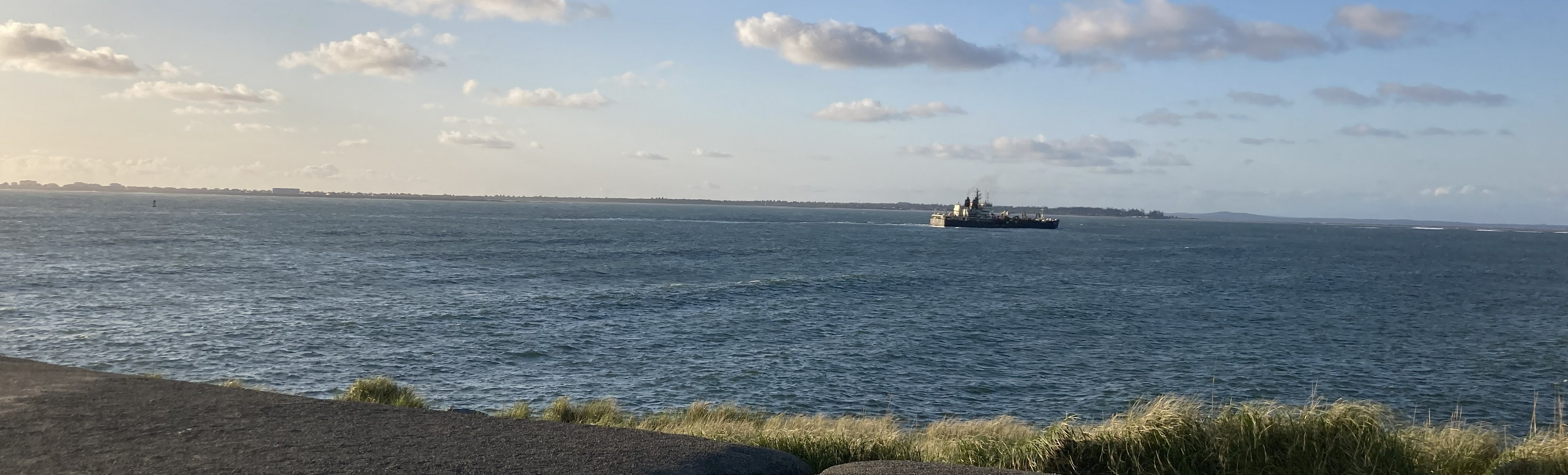
Striking out into the desert, I was determined to put the malaise of the past few days behind me. The first order of business was christening my Jeep stroller. It had suffered a flat tube for 90 miles, blown out the tire, and bravely offroaded up mountains where no stroller had gone before. With the tire fixed, and backup tubes mailed to myself via the Ellensburg Post Office (the tubes were of a very specific size), it was back to rolling smoothly. I'd let my friends vote on the name, and as I rejoined the Palouse-Cascades Trail I found myself at the helm of Fancy "TurboGlyde" Nancy. My aim today was to make it across the Columbia River via the Yakima Training Center, an arid hillscape-turned-military base that flanked this part of the trail on both sides. Dividing Yakima's bluffs from the last traces of civilization was Renslow Trestle, a magnificent steel span that towered over 100 feet above the highway below. Bracing against the wind, I pushed on into No Man's Land.

The first thing I noticed about my new environment was the carnival of budding flowers and scrub bush lining the trail. The second thing I noticed was the sand. Instantly the wheels of the stroller were sucked into the grainy earth, carving small troughs down the path. I may as well have had three flat tires for all the good it did me. A few minutes later, two women on horseback emerged from the sagebrush, and I pulled back the reigns of Fancy Nancy to let them pass. They stopped, confused at first, politely wondering what lunatic would take his newborn on a solo jog through the desert. I explained my quest, and learned they were barrel racers who used the trail to condition their horses to the terrain. I asked if it was sandy all the way to the Columbia. It was. One of them thrust something into my hand as we parted - I discovered later it was a $20 bill - and I ran onward feeling grateful to experience all the good in the world.

Thankfully, the barrel racers were wrong. The trail soon turned rocky and the wind, which had been gusting all day, pushed me toward the river like an invisible landslide rolling off the mountains far behind. For days I'd gotten used to traveling at walking speed, or slower. Now with the wind at my back, 20 miles passed in an instant as Fancy Nancy careened over old rail rubble at a breakneck seven miles per hour. I was buzzing at the change of pace. An eternity later the trail crossed the Columbia River and I, caught in the strongest crosswinds of my life, held onto the stroller for fear the deafening wind would snatch my belongings and fling them into the mouth of the great blue snake below. My feet touched land, my pack unscathed, and as the wind died I trotted off toward the town of Beverly.


Crab Creek | Mile 317 | Strava
Beverly had no resupply stores, as I had hoped, but instead was comprised almost exclusively of small homes with large dogs. Behind flimsy patchwork fences of corrugated iron, wood pallets, and wire, they strained against their property and sounded a barking alarm that was soon echoed by every canine in a half mile radius. Eager to leave town, I made for the 76 gas station in nearby Schwana. An Indian man (as in India) behind the counter watched as I pulled the stroller through the door and started examining his selection of gummy worms with a scientist's eye. Frustratingly, many of the gas stations in Washington do not list prices on all their items, making the CPD (calories per dollar, you will recall) difficult to discern. My main objective was to stock up on water, but his soda machine was broken. This was a problem. As I paid for a dozen bags of gummy candy (my solution to last week's calorie deficit), he beckoned me to wait while he cashed out another patron. With no one else in the store, he stepped around the counter and handed me a free gallon jug of spring water. He'd found my Instagram and, through broken English, realized I needed more water for the journey ahead. I shook his hand and trotted away toward the dunes with my prize, amazed at the kindness of strangers.

Camp was a primitive site another six miles from town, and as I ran I marveled at the towering 1,500-foot bluffs and flying saucer-shaped clouds that framed the landscape. After struggling to confirm which dirt pull-off was my legal campsite for the night, I opted for the most sheltered option. It was a small basin, walled by the foothills of the bluffs on all sides, and tucked out of view of the road. The floor was sand littered with bullet shells and broken glass, and in the center it appeared that someone had recently burned a massive bonfire of tomatoes. Corpses of the dried fruit laid strewn about the sandy bowl, most of them piled in a shriveled mass in the center. I set up my tent as far from the shrapnel as I could, half sunk into the uneven slope, and prayed the beer-drinking gun-firing tomato haters didn't return for another evening ruckus. That night I barely slept. The winds whipped my tent around me, unrelenting even as the temperatures cooled, and I gave up on rest an hour before dawn. I checked for rattlesnakes - there would be a few serpentine surprises for me on my journey east - and rejoined the road an hour before sunrise, admiring the vermilion slopes of the bluffs in the pre-dawn light.


Othello | Mile 345 | Strava
I was doing my best to enjoy the sunrise, but in truth, I was miserable. The distance was hard - that was expected - but I felt like a social outcast, hiding from imaginary tomato-burning rednecks and burying my number two far from prying eyes in the arid plateau. I could feel the effect my journey was having on my parents and my girlfriend, and I knew they wanted me to stop. Internally I believed that things could turn around. It was a long way to the Atlantic, and there were bound to be days or even weeks when I would feel low. Like the changing scenery day after day, those feelings would pass. But I was living in a different world now. The people I cared about most back at home saw only my struggle, and it hurt them more than me. I walked for hours and cried. I felt trapped. Eventually I called my girlfriend, who suggested I could run across states one at a time. Something as big as a run across the U.S. simply wasn't worth doing unless it was done right, and I had done anything but set myself up for success. I liked the pivot - it solved my budgetary and timeline problems, would leave my relationships in a much better place, and did so without sacrificing on ambition. I checked myself into a hotel in Othello, wolfed down two Subway footlongs, and considered my options. If I was going to change my plans, I was going to do it in a healthier state of mind with food in my stomach and a mattress under my legs, not tear-stricken in the desert from lack of sleep and physical exhaustion.

I left Othello at 10am the next morning with a new goal. Idaho was still 130 miles away, but it was attainable, and a friend of mine was driving down to the border town of Tekoa to run the last three miles with me. I could round out the state of Washington, and she'd drive me back to Spokane where I could catch a flight home to recover and compile everything I'd learned for the next adventure. I had a feeling I wanted to run New York, my home state, which would grant me the opportunity to share my project with close friends and family in a positive way. I just had to get there first. The Palouse-Cascades Trail, which I had been following since Snoqualmie, was unfinished west of the Columbia River and contained many detours and road walks between Othello and Tekoa. I decided I'd forge my own shortcut, since I was running off-trail anyway, and set off onto an endless treadmill of flat, foul-smelling irrigation circles.

The putrid stench of fertilizer haunted me for most of the morning. Whenever merciful wind wafted the odor elsewhere, I fed myself knock-off
Oreos from Othello's Dollar General. My steady supplemental diet of candy, with sugars simple enough to be digested while in motion, had finally solved
my calorie deficit and I was once again running smoothly. My shortcut took me through a railside locale called Beatrice, which appeared
to be comprised of a single large agricultural factory. The liveries on their 18-wheelers proclaimed "Naturally Nested, Naturally Organic, Naturally Omega."
The stink coming from a dozen rows of enclosed metal poultry warehouses said otherwise. I held my breath as I ran through a cloud of stinging
chemicals that was being piped out of the ground and blown across the road. I didn't know what "Naturally Omega" meant, but if this counted as
an organic farm, I certainly hoped I never had to smell the alternative.
Eager to push on to a safe camp, I ran until dusk all the way to Ralston,
48 miles from my hotel in Othello. I raced a threatening sky over forearm-rattling rubble, rejoining the Palouse-Cascades Trail for the final
two miles and setting up camp under a lonely drooping spruce (the first real tree I'd seen in days). The sun set, a glorious red mirrored by a double
rainbow, and as the winds picked up, my tree shelter felt like the coziest place in the world.


Cow Creek Crossing | Mile 402 | Strava
The winds rampaged throughout the night. I awoke more than once to double check, via spotty cell service, that I hadn't missed a tornado warning, but the sun rose on a quiet town (more of an intersection, with a small park and a grain silo) very much still standing. The park pump was dry, but I'd left Othello with eleven liters of water so I wasn't much bothered. I didn't yet know it, but those eleven liters would last me comfortably through three days and approximiately 115 miles of otherwise dry terrain. I tresspassed briefly to make use of the porta potty at the grain silo, then rejoined the trail across the street to make for Cow Creek Crossing. I'd heard the bridge was out, but the local rancher owners had apparently allowed a detour through private land. On my komoot map, there was a tiny singletrack trail near the old bridge crossing. I hoped it'd be suitable for me and the stroller.

The trail approaching Cow Creek navigated through surprisingly rocky canyon-like terrain - proof again that Washington's landscape
changed every 30 miles - and as I approached I saw that the bridge was indeed out. In fact, it was not just broken, but missing entirely.
A quarter-mile chasm separated me from the other side, and peering ahead, I had no idea how I was going to scale the opposite enbankment. I
wrestled Fancy Nancy off the trail and carried the stroller, carefully, down a small bluff to get a better look. The supposed detour on
my map led straight off the edge of a cliff. Just as I was contemplating my options, a white pickup truck pulled by on the road far below
and slowed to a halt. Someone or something, too far away to make out, poked out the window.
"Hi!" I called, and waved. "Is this the Palouse-Cascades Trail?"
"You're going to jail!" was the bellowed response. That hardly seemed reasonable, so I tried again. "Is this the Palouse-Cascades
Trail?" I may (or may not) have gotten some sort of sputtering answer to the affirmative, followed by "Have you ever heard of tresspassing? This is private
land! You're going to jail!" I stepped back from the edge of the cliff, out of view, and started hauling my stroller back up the bluff. I had
no intentions of going to jail, but I didn't want to be shot by an angry rancher shaped like a sea lion either. I made it back onto the gravel
path and took off at a sprint the way I'd come.

One mile later, just as I was crossing a dirt road, the same white pickup roared up the hill to my left. I sprinted on. It turned onto the trail and pulled up behind me. I stopped, terrified, holding up my hands and apologizing profusely, as the window rolled down alongside me. The rancher's wife was between me and the thick-necked man, and as he struggled to control his temper, I explained that I was following the trail and looking for the Cow Creek Crossing. "This isn't it!" He bellowed from the other side of the cabin. The rancher's wife explained that they didn't like people getting close to the cows. I hadn't seen a single cow in the past six miles, but nodded understandingly as she told me the allowed detour was back the way I had come. She chuckled "You're a braver soul than I" when I explained I was running across the country, and the pair turned away down the road in a cloud of dust.

After backtracking three miles, I found the turnoff I had been told about. It was a nearly invisible dirt line through a cow pasture, and contrary to the rancher's adamant arguing that I had pushed past "NO TRESSPASSING" signs to get to the broken bridge, both the detour and the main trail were unmarked. I had half a mind to call and tell him this, hopefully sparing other trail users, but I'd seen no one else for days and decided not to push my luck. It was a good thing I'd run into the couple in the pickup, for the detour (occasionally marked with trampled "CCC" signs laying in the grass) sent me right through the gates of cow pens, and many times I had to keep my distance and wait for cattle to stop blocking the trail ahead. If not for their clear instructions, I definitely would have felt I was tresspassing and taken the much longer road detour to avoid another confrontation. Re-emerging onto the Palouse-Cascades Trail, I breathed a sigh of relief and walked for a few hours. I had all day to get to Revere, where I would camp at Rock Creek on BLM land, and I was in no hurry. I passed multiple white signposts declaring the names of towns that did not seem to exist (these had shadowed the trail since Renslow Trestle, and I found them very entertaining) and trundled on toward the Revere grain silo as it slowly appeared in the distance.


Rosalia | Mile 422 | Strava #1 #2
Rock Creek was one of the most beautiful places I experienced on my journey east. Its verdant windswept bluffs sheltered a lush, vegetation-crowded river - the reeds lining the bank were dense enough that I once again elected to pass on filtering water, instead saving my last liters from Othello. After days traversing farm circles and ranchland, it felt wonderful to be back in a more natural environment with brids, diverse flora, and (as evidenced by many midnight yips and howls) coyotes. As I dusted the frost from my tent, and admired the sunlit morning fog filling the valley, I was reminded of why I set out on this cross-country quest to begin with. I felt extremely lucky to stand there in the warmth of the dawn, in a place that few others would ever experience. Today would be my last full day on the trail. I started running.

Due to more detours around private farms, I spent all morning climbing through rolling green hills on gravel roads that appeared to wind endlessly between potato farms. I felt like I was lost inside a 3D Windows screensaver. Eventually, I crested a ridge and the landscape unfolded before me. For the first time in about a week, the horizon bore forests and low green mountains. It looked like the Shire. I drifted down and stepped off the gravel farm road onto hard asphalt - no longer would I have to push the stroller over energy-sapping loose stone. Every day in Washington I'd woken up in a new landscape, and I was swallowed this time by a spacious pine forest as I ran toward Malden. This town, just twenty-something miles from the Idaho border, had burned down completely in a recent fire. I had expected to see ruins, but was surprised to find a plucky hamlet well into the process of rebuilding, despite the charred stumps and evident damage that remained. My last stop for the day was Rosalia, one final climb into the sky up a three-mile hill leading out of town. Despite the 450-odd miles I had traveled from the Pacific, none of it had really felt like running in the sense I was used to. When it got steep, I'd walked; when I got tired, I'd stop and have a snack. This time, I lowered my head in the direction of the hill and ran.


Tekoa | Mile 476 | Strava #1 #2
I'd love to say that the final sixteen miles toward the border were triumphant, and I ran strong. The truth is that I arrived in Rosalia early in the afternoon, discovered the campsites there didn't open until Memorial Day, and walked back to the Palouse-Cascades Trail to find a place to stealth camp. In the process, I sent a thorn through one of Fancy Nancy's tires and got another flat. Even though the signs for the trail clearly stated "NO OVERNIGHT CAMPING" (along with no potable water, no cell service, rattlesnake warnings, and so on), I figured I was the only one crazy enough to use the Palouse-Cascades Trail in its current condition, and set up my tent in the middle of the trail to watch the sunset. The next day I packed up before dawn, just in case, and started walking toward the border. The Tekoa library where I would meet Grace - my friend from Spokane - didn't open until 1pm, so I had plenty of time to walk, take a few naps (which I did), and enjoy the scenery. In all honesty, I was ready to be done. My body after two weeks had adapted to life on the road - running for 40 miles per day felt normal by now, I had caught up on calories, and I'd gotten used to dealing with extreme terrain. I felt that I could have kept going, no questions asked. But I was lonely, and wanted to share my stories with the people who had been anxiously fretting over my safety for the past fifteen days.

The librarian in Tekoa was psyched to hear that I'd come off the Palouse-Cascades Trail, and insisted I sign the first entry in a new logbook she drew up for passing travelers. Grace, too, was smiling from ear to ear, and our arbitrary jog to the Coeur d'Alene border sign held a special sense of occasion. The previous day in Rosalia, as I'd purchased a stack of tortillas and pre-cooked sausages from the market, a middle-aged local woman had stopped and asked to shake my hand upon seeing my sign. I was hesitant at first, not having showered in days and lacking in basic hygeine, but she cut off my caveats and greeted me anyways. She clearly saw something that I, in the moment, had not. Her expression was one I'd seen before, in the best moments of my trip. She wasn't smiling because of me - we barely knew each other. Rather, I think it was the fact that during our brief interaction, mundane life was forced to accommodate unusual people doing impossible things. For two weeks I had been living in a different world, outside the expectations and limitations of normal society. For two minutes in a small grocery store, she did, too. Since starting my trip, I'd been a partial mirror of the landscapes and challenges I'd experienced. In dozens of friends, family members, and transient acquaintances on the trail, for better and for worse, I saw versions of the same images I'd projected reflected back at me.
")